Milestones on the A417 – B4211
This route is almost complete – only two stones were missing at the time of recording, although one on Maisemore Ham has since been found and re-erected. The other most likely removed when the M50 was constructed.
Almost all are limestone. Metal plaques are introduced on the B4211. The two in Longdon Parish are of red sandstone, which indicates a local source.
The measurement from Gloucester starts at the Severn crossing – perhaps the toll gate?
The turnpike dates for this route are 1726 to Hartpury, 1747 to Staunton.
| OS / Location | Dimensions | Image | Notes / Comments |
|---|---|---|---|
| c. SO817204 Maisemore Ham MS |
Not found | ||
| SO812213 Maisemore Right |
93x43x37 | 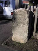 |
Space for plaque Limestone |
| SO803227 Overton Right MP |
80x36x23 | 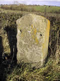 |
_L_ST_ _ 3 M I _ _ S Once painted white Limestone |
| SO798241 Woolridge Farm Hartpury Right MS |
81x35x23 | 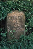 |
GLOSTER 4 MILES Incised lettering Limestone |
| SO798255 Watersmeet Hartpury Right |
100x42x20 | 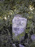 |
GLOSTER 5 MILES Limestone |
| SO798275 Corse B4211 Right MS |
143x30x43 | 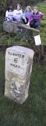 Now restored to upright position |
GLOSTER 6 MILES Trig mark Broken and lying down Limestone |
| SO807288 Straight Lane JunctionLeft MS |
97x44x40 | 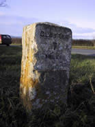 |
GLOSTER 7 MILES White with black lettering Limestone |
| SO823299 Right MS |
94x63x27 | 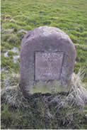 |
ELDERSFIELD UPTON 8 GLOSTER 8 MILES Iron plaque once painted white Limestone |
| SO833311 Corse Lawn Right MS |
106x44x27 | 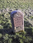 |
ELDERSFIELD UPTON 7 GLOSTER9 MILES Leaning to left Limestone |
| SO842324 Right MS |
139x68x24 | 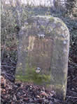 |
L W Scratched on top Plaque removed Red sandstone |
| SO848337 Right MS |
125x56x24 | 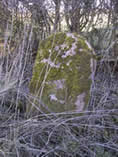 |
Plaque removed Leaning backwards Red sandstone |
| c. SO842353 | Perhaps lost or Removed when M50 constructed | ||
| SO835365 Longdon Right MS |
70x55x26 | 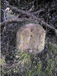 |
Plaque removed Red sandstone |
| SO840379 Right MS |
111x45x21 | 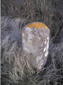 |
Plaque removed Trig mark below plaque Red sandstone |
| SO845395 Right MS |
66x57x33 | 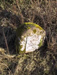 |
(x22 on worn side) UPTON UPTON 1 GLOSTER 15 MILES Plaque white with black lettering Red sandstone |